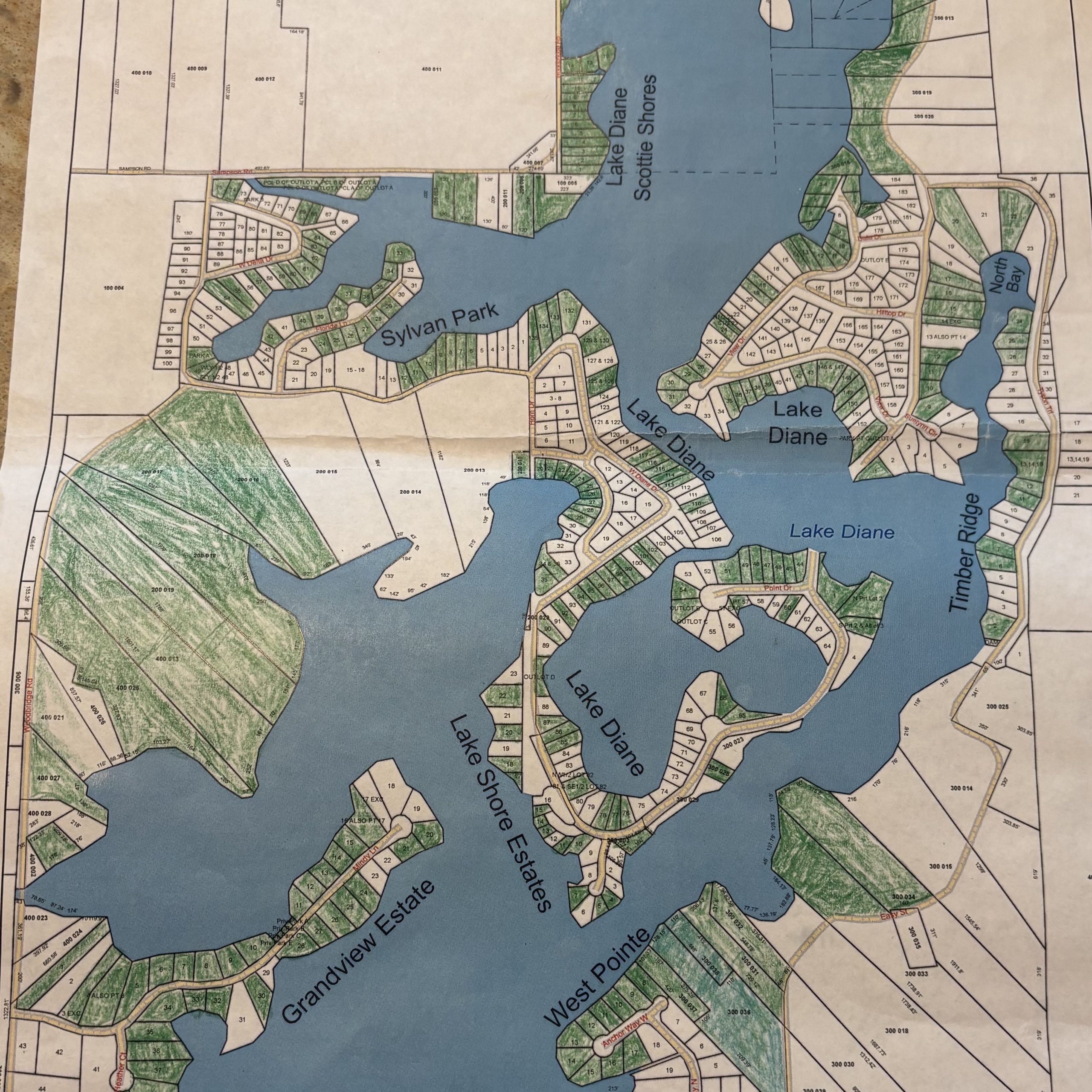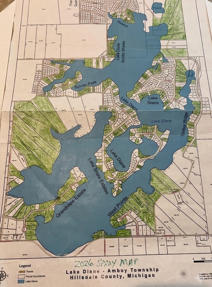
This map is used to give GPS coordinates to treatment process – this information is locked in.
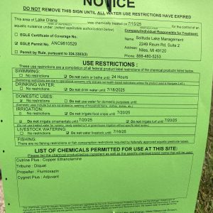
`26 Treatment scheduled for Monday June 22nd
rescheduled from June 17th – weather permitting
Flag Posting is used to share public information and does not indicate treatment areas – any updates will be posted here and on LDCA facebook:
- notify the public and landowners of the treatment and restrictions as a result for the safety of animals, plants, and humans
- help the navigators on the boats see where the GPS locations are for treatment and non-treatment.
Flag placement will not be accurate to the lot lines of your property. Treatment is done via GPS navitgation. Flags are also placed in regions to be treated and regions to not be treated. For example, 10 lots in a row may only have two flags. Moving the flags will not cause a change in treatment as it is only used to help orient the navigators and not the GPS location of treatment. If you observe a section is grossly incorrectly treated (ie. an entire area is skipped) please notify the LDCA board to have it corrected ASAP while the treatment is happening (i.e within minutes if possible). An example of an error to notify is if there are no signs on your lots or neighbors lots and there is supposed to be a spray and non spray in that area. Do not notify if your lot is missing a sign – check the signs around you to the map as it may be part of a larger region of multiple lots.
Here is an example flyer from years past.
Please ensure your irrigation systems are turned off Monday and follow the posting on your lawn or check back here or with LDCA for restrictions
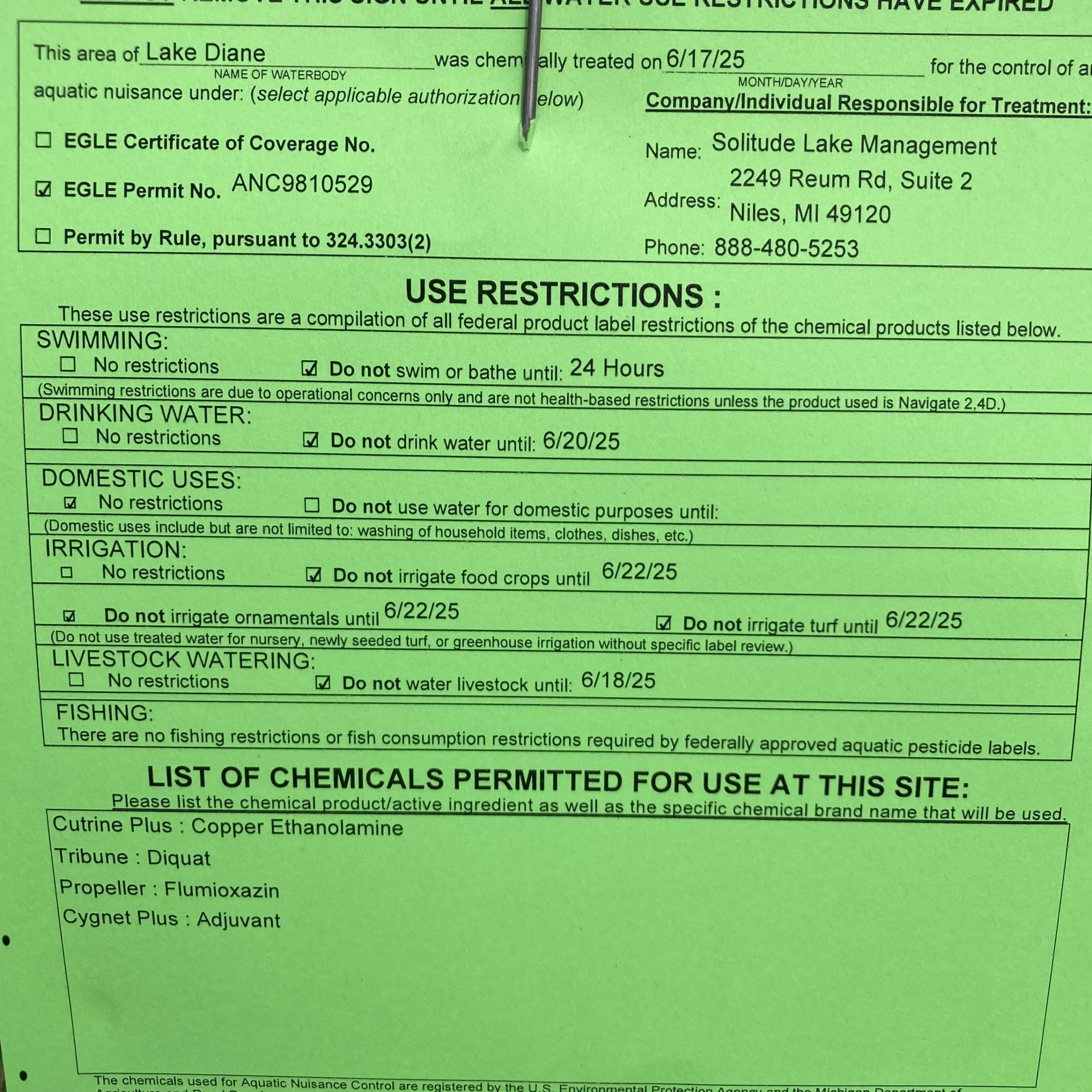
The LDCA is happy to announce that the permit and logistics for approval for weed treatment has been granted.
For information about being part of the program next year, please visit Lake, Water Quality, and Weed Management
 (updated with most recent EGLE posting)